Wialon: agricultural solutions

17 julho, 2015
Anna Glonassova
5abcbb4e0e4d4

Farming is changing. Equipment fleets are expanding. Costs are obviously rising. It is essential, therefore, to cope with factors that fleet managers everywhere are turning to the logistical advantages. A modern agriculture company usually maintains a great number of fleets such as harvest technic, freight transport, fuellers and so on. The vast majority of total expenditures go to fuel and technical support costs. Despite the fact that GPS tracking in agriculture sector is slightly different from traditional monitoring,  Wialon agricultural applications have been successfully advanced with regard to this great demand. Especially when it comes to the agricultural domain, where our system has been successfully in use for over 5 years already. 

AgroControl module

Module capacity

  • Agricultural equipment online tracking;
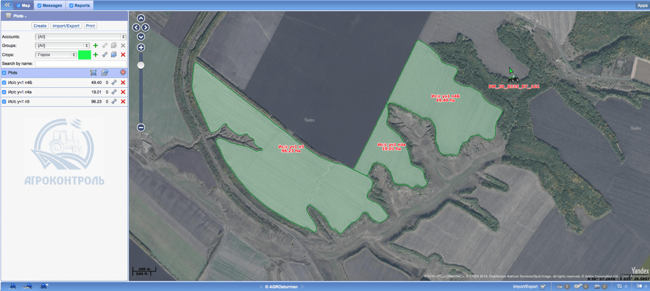
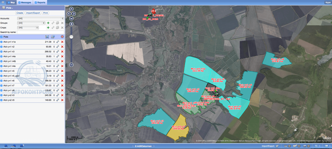
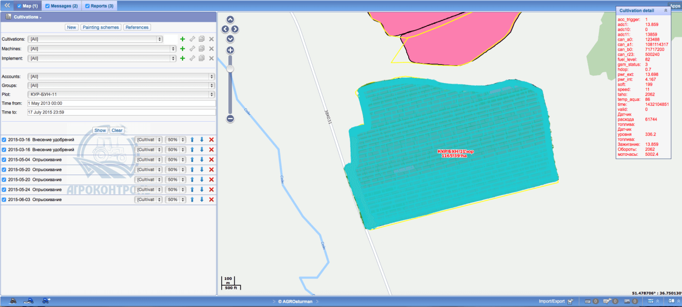
  • Farmland working area metering. You can name different parts of farmland for easy navigation, count total area, mark borders between fields on the map and arrange geozones. The module can also track filed operations in progress;
  • Driver authorization system;
  • Agricultural equipment detection;
  • Field logistics optimization. You can calculate the distance between units on the map and trip time between geozones;
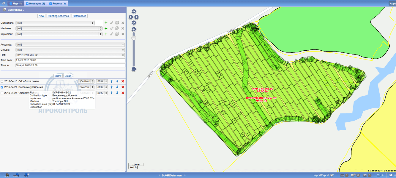
  • Reports on agricultural equipment performance and cultivation;
  • Precise data on crop rotation (including year, cultivated plant and yield);
  • Data storage system (contains information on every working area);
  • Fuel level control and fuel consumption over given time;
  • Option to print field maps.

Agro Using Wialon-based modern data processing systems, AgroControl provides detailed description of farmland working areas and stores information on every field where farming operations have been done recently. agro The AgroControl module is compatible with Trimble (parallel driving system). If you use Trimble direction indicators, you can add, monitor and analyze working areas and agricultural equipment performance with the help of module database and import data into the system. This technology is known for accurate track positioning (up to 2,5 cm) which is really important in agriculture and helps to maximize your ROI. agro   agro The AgroControl module is distributed by Gurtam partner ‒ AgroShturman Company. So far, the module has shown great results; we’re still working on the system, offering new options for better tracking and performance.

Eflotta Agro App

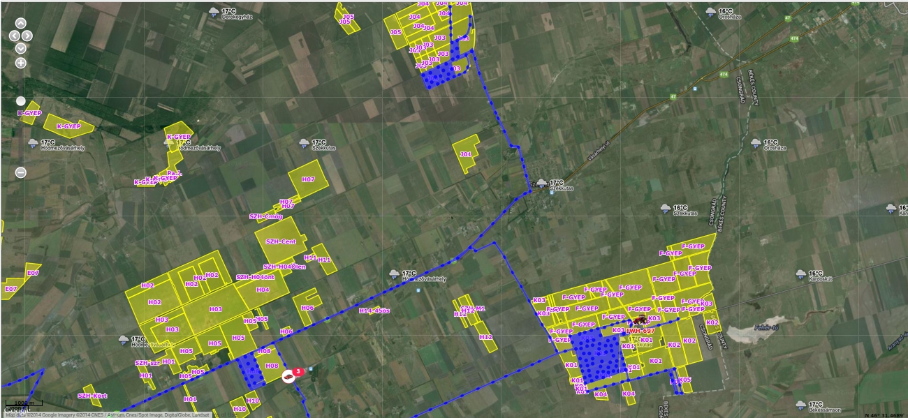
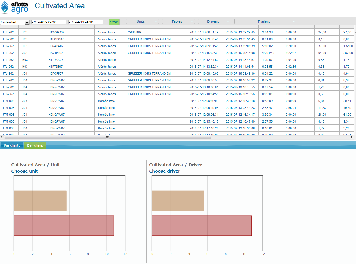
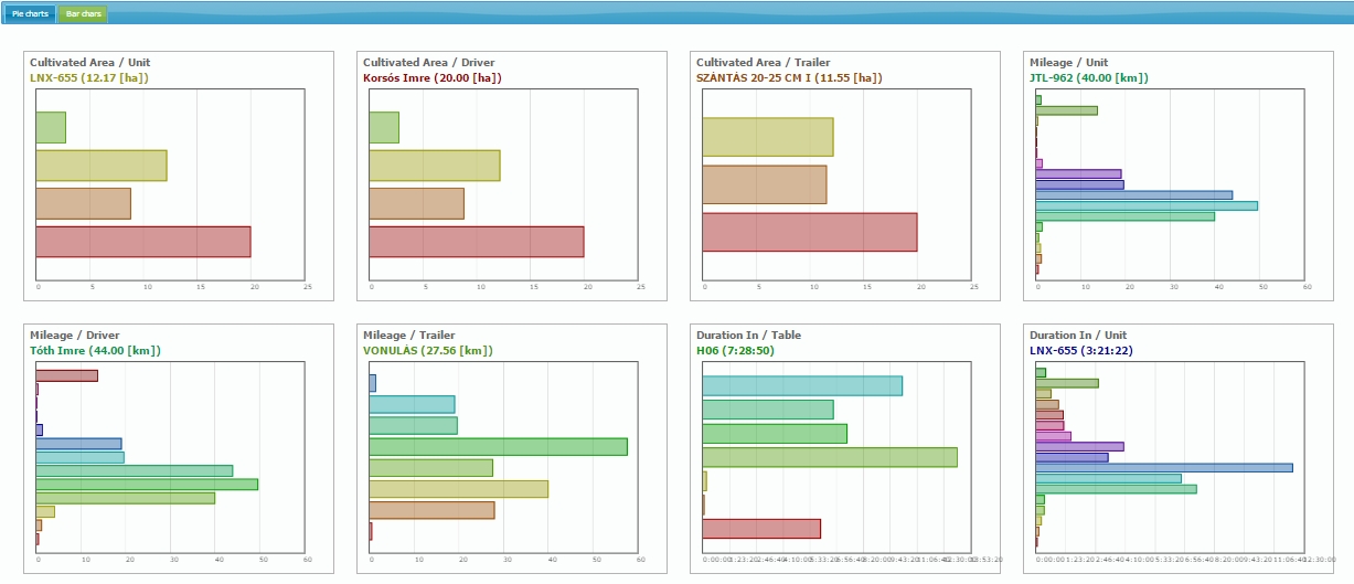
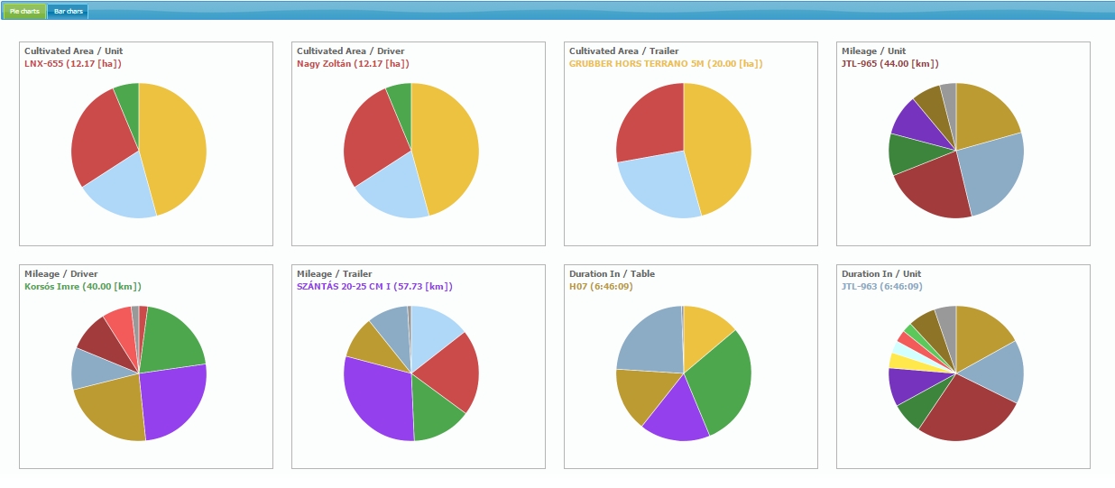
Our trusted fleet management solutions provider ‒ Eflotta Vehicle Tracking Ltd ‒ has built up another agro app on Wialon platform. Eflotta Agro is a powerful tool to control the agricultural field works. The system tracks the units’ movement and the operating parameters (position, speed, fuel level, etc) continuously, which are presented in tabular forms and on special map views. Farm fields can be registered easily to the aerial photo maps, so the users can follow up on the maps the actually performed works, the size of the cultivated area and the coursing between the fields. The system supports the identification of tractor drivers and working machines (hanged behind the tractors), providing a complete overview of all parts of the farming process. Agro3 Based on the received and system stored data: Tractors, Fields (geofences), Drivers, Working machines (trailers). It is possible to make special geofence based reports, which allows to get an accurate view of the completed field works and the performance of tractors, drivers and working machines. This report shows time and frequency with which unit visited different fields, duration spent there, the mileage and the fuel consumption during this period. Agro App You can easily check the machines working time and the unnecessary loss of ad hoc "rest" and "repair" times as well. Average and maximum speed date can also be viewed for each field, which is a great help to control "speed critical" operations. The size of the cultivated area can be compared to the actual size of the field, so it becomes visable, if the area has not been cultivated entirely, or if the driver has worked with overlap. The system displays the data in tabular and graphical forms. The charts can also be exported and printed for further use. For online data analysis two types of graphs are available below the table: Pie charts and Bar graphs. agro_appagro_app2 The Eflotta AGRO APP uses Wialon SDK module and it is available in the Apps menu. The App is based on the Geofences report (with some special filtering); it takes every single column from the report (column names & values) and adds the following columns to the new report:

  • Cultivated Area;
  • Consumption on cultivated area;
  • Consumption by time.

The Eflotta Agro app is under a continuous development. In the near future, Eflotta is going to implement “Crops”&“Capacity” planning and scheduling, and profit forecasting menus, also supplemented with some special reports and graphs. Today GPS tracking is widely used in farming. 

We are really pleased that our partners can offer functional and competitive IoT-based farming solutions to the market. Keep it up, guys! Stay tuned for news and updates and have a good day.

Anna Glonassova
Anna Glonassova
A Anna é a pau para toda obra da equipe de marketing da Gurtam. Ela está envolvida em todas as atividades, desde a comunicação com os parceiros Wialon nas redes sociais até a transmissão ao vivo de eventos da comunidade.

Compartilhar