We’ve already shared a lot about the Wialon Challenge Dakar 2026 — our boldest partner event yet, played out in the heart of the Saudi Arabian desert this January. You’ve met the 4 teams who tested their endurance and bravery, seen the missions, and felt the vibe.
But there’s a part of the adventure we haven’t told you yet.
Because there was another hero quietly at work: Wialon. And this time, we’re telling the story from its side of the dashboard.
Special mission: Tracking the road to Dakar 2026
“They were heading to Saudi Arabia’s desert. I was already there.” — Wialon
In case you need the short explanation of what connects Wialon and the Dakar Rally: Gurtam has been the partner of the Gurtam Toyota Gazoo Racing Team Baltics since 2024. At the helm of the team is Lithuanian racing legend Benediktas Vanagas, who tackled his 14th (!) Dakar in 2026.
And while we were preparing for the Wialon Challenge Dakar, we couldn’t resist a fun side mission. When the Gurtam Toyota Gazoo Racing Team’s support truck — and Benediktas’s Toyota Hilux inside it — began their journey from Vilnius ahead of Dakar 2026, we hopped on board. The Wialon way, of course — by monitoring the entire route.
Vladimir Tihonchuk, Technical Care Engineer at Wialon, installs the trackers; Benediktas Vanagas is by his side.
We expected highways first, then the open sea. Our solution was a combo:
- Topflytech TLW2-12B — for GSM tracking on land. Its large internal battery proved especially useful when the truck stayed parked with the ignition off for long stretches.
- Garmin inReach Mini 2 — for satellite tracking once the truck was loaded onto a vessel and headed across the Mediterranean.
Tracking the journey wasn’t just for us. Thanks to Locator — Wialon’s tool for sharing live vehicle locations via an external link — the team and curious fans could track the journey in real time, no accounts or registration needed.
Artem Filimonchyk,
Head of Technical Care L2 at Wialon
“Near the Suez Canal, the track suddenly turned into a strange spiral. It wasn’t a glitch — the ship was literally circling, waiting for its turn to enter the strait.”
Apparently, traffic jams really are everywhere these days.
According to Wialon data, the entire convoy — including the race car and support truck — traveled 6,817 kilometers from Lithuania to Saudi Arabia.
Wialon Dakar Challenge: The technical setup
“I went from fleet monitoring to managing a desert trip: talk about an unexpected career pivot!” — Wialon (updating its LinkedIn profile)
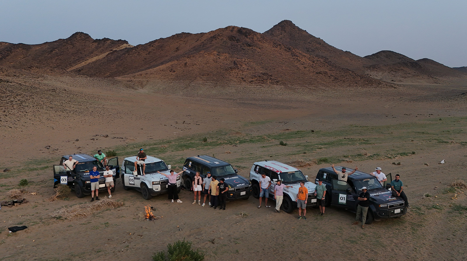
The support truck finally reached Saudi Arabia, safe and sound, and our team’s mission shifted to managing a unique competition for our partners.
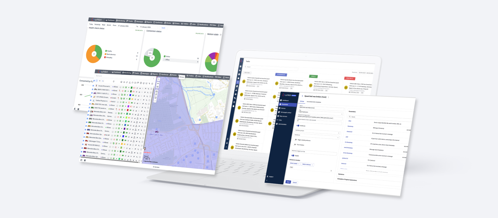
Admittedly, Wialon wasn’t designed with a multi-day race in mind. But it was built to be versatile and flexible. In the hands of our Customer Service team, those qualities transformed a fleet digitalization software into the technical backbone of the most demanding partner event we’ve ever hosted. Out in the Saudi Arabian desert, Wialon wore many hats: a control center and safety net, a messenger, a navigator, and a referee.
The new mission meant a new hardware setup. This time, attention turned to our Dakar Challenge fleet — five Toyota Land Cruiser Prado vehicles driven by partner teams and the organizing crew. Each was equipped with two GSM trackers:
- Teltonika FMC800 (OBD tracker)
- Teltonika FTC880 (wired)
Connectivity was powered by Onomondo, which supplied SIM cards with international coverage.
Each team also carried a satellite device — a Garmin inReach Mini 2 — for areas without GSM coverage.
A quick spoiler from Artem Filimonchyk:
“We were actually surprised by how good the connection was in most parts of the desert! We’d fully expected to rely solely on satellites out there.”
The devices were configured back in Vilnius, with a key factor in mind: participants would be driving a lot, and some missions would require frequent data transmission. The settings needed to be sensitive enough for real-time objectives, yet stable enough to filter out “GPS noise” — those minor signal glitches that cause sudden jumps in location.
And installation? That became the first trial for our Wialon Dakar Challenge participants.
The hardware part went smoothly. But then came the twist: every tracker ID was intentionally pre-registered to the wrong Wialon account.
__CTA_BANNER_001__
Software, driving the challenge
“You gave me a mission, I gave you a workflow.” — Wialon
The account setup relied on familiar fleet-management logic with a competitive twist.
The top-level account served as our “Mission Control,” giving the Technical Care team full visibility into every vehicle.
The top-level account for the Technical Care team is to facilitate the challenge.
Each team — Blue, Red, Green, and Yellow — operated within its own account, much like a typical client project. The on-site organizing team, White, had its account too, with extended access rights to oversee the competition.
And there was plenty to oversee! The Wialon Dakar Challenge featured 68 unique missions, ranging from souvenir trading to camel diplomacy. They tested driving skills, quick thinking, creativity, and even luck.
__CTA_BANNER_002__
A handful of missions were controlled by Wialon functionality. Let's be clear, none of those were designed to showcase Wialon features. Nobody sat down thinking, “Let’s build a mission around this tool.” Quite the opposite: the idea came first, and Wialon adapted to it — just as it does in real-world business.
Turns out, the most exciting moments were made possible thanks to Wialon’s core tools — the same ones our partners have relied on for many years. Let’s take a closer look at the features that truly got their moment under the desert sun.
Geofencing in the middle of nowhere
“Give me a geofence, and I will move the desert.” — Wialon (channeling Archimedes)
Geofences — a core fleet management tool — become indispensable in the desert for one simple reason: there are no addresses in sand and rock. Starts, finishes, checkpoints — key locations had to exist digitally. So we turned them into geofences and paired them with automated notifications.
Take the Desert Picnic mission. At 12:00, teams received the coordinates of a scenic spot. Their objective: enter this geofence as close to 13:00:00 as possible. The system automatically crowned the most punctual crew (Green) the moment their Toyota entered the geofence.
On the Wialon map, the tension unfolded in real time — the Red team overshot the zone and doubled back as others closed in. Team Green took the win.
The action scaled up in the Dakar Navigation mission. Armed with only a paper map and compass, teams had to reach a series of checkpoints. Behind the scenes, each one was a geofence in Wialon, providing the organizers with automated proof of every team's visit.
Checkpoints weren't always easy to find.
Pavel Chabatarou, Technical Care Engineer at Wialon, recalls the moment the Yellow team lost their way.
Pavel Chabatarou,
Technical Care Engineer at Wialon
“For nearly 40 minutes, their track moved back and forth near the checkpoint. On our map, the route was obvious; in the field, it wasn’t, so we sent coordinates to their Garmin.”
Another standout moment? The SVR Chase mission — inspired by a real fleet scenario: stolen vehicle recovery. One car received a five-minute head start. The other had twenty minutes to track it in Wialon, catch up, and read the secret code on its rear window. The entire chase played out inside a “Game Drive” geofence — our digital arena. The rule was to stay inside the zone.
Pavel Chabatarou notes that Wialon allows for far more complex setups:
“There’s a notification called Interposition of units in Wialon that controls the relative position of vehicles in real time. Our Australian partner uses it for road trains, where the distance between multiple trailers must be monitored. But in a desert chase where the roles of cat and mouse switch in seconds, we chose simplicity.”
The Green team relied on dust as their defense, kicking up thick clouds to conceal the code on their rear window and tracing mysterious circles across the desert as a result.
Geofences helped to run several other missions (and decide the leader). Prologue Pole Position — first vehicle into the start-area geofence wins. Desert Pitstop Arrival — precise entry timing into the geofence decides the score. The Final Sprint to Jeddah — cross the digital finish line (another geofence!) first.
Team Green went the extra mile, visiting not only the Prologue Start but also the Prologue Finish geofence.
As Artem Filimonchyk adds, managing this complexity was faster thanks to Wialon's geofence groups functionality: “It allowed us to grant or restrict access to entire sets of zones instantly.”
The pulse of notifications
“Keep calm and check your notifications.” — Wialon
As mentioned earlier, geofences were paired with automated notifications. Teams received updates mainly via Telegram and Garmin inReach.
But why stop there? It would be far more useful if Garmin notifications added context — who entered a geofence, when, and where. Or alert only the crew of a car that had exceeded the speed limit. In practical terms, that meant monitoring speed on one device while sending a text command to another. Not exactly a standard configuration — but by now, you can probably guess: our team doesn’t step away from a technical challenge.
Pavel Chabatarou explains:
“The teams were already in the desert, so I had to bridge the gap using the Wialon API — fetching notification events, mapping them to the relevant Garmin devices, and triggering custom commands. With no time for manual coding, I turned to AI. I provided the logic and API flags, and Gemini generated a Python script in minutes.”
The takeaway? Even when a feature isn’t available as a ready-made setting, Wialon’s API provides the flexibility to build the required logic. And with the right expertise — plus a bit of AI support — solutions can be developed on the fly, even in the middle of the desert.
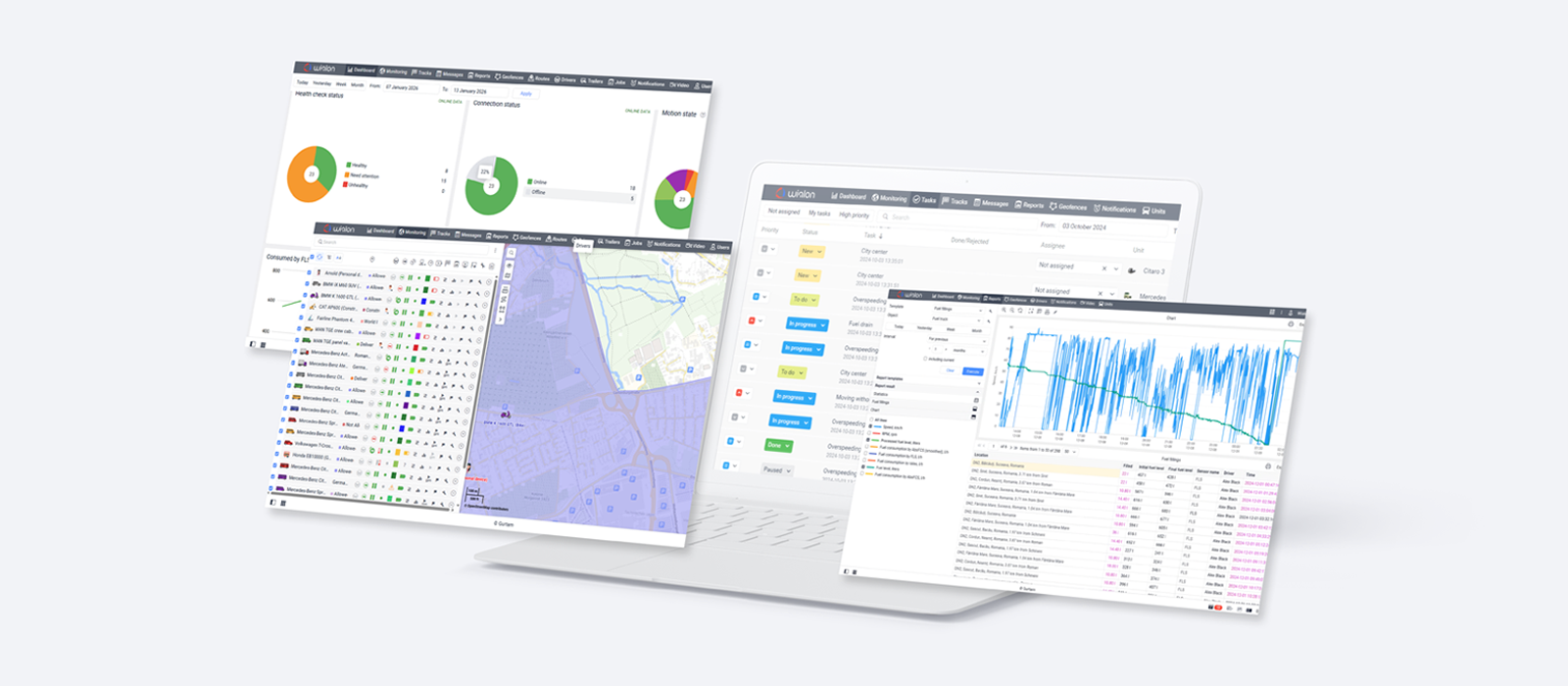
Reports and Jobs: Turning distance into points
“What happens in the desert stays… in the reports.” — Wialon
Wialon offers a wide range of reports to analyze fleet and driver data. In the desert, however, those reports became the judge for our daily awards.
Several missions were decided entirely by metrics. “Road Warriors” went to the team that covered the greatest total mileage per day; “Efficient Navigators” to the one that drove the least. Speed reports ensured that enthusiasm never edged into recklessness.
At the end of each grueling day, while participants were busy shaking sand from their boots and clothes, Wialon handled the calculations. Using Jobs, the Technical Care team automated the process: the system generated the necessary reports and emailed them directly to the organizing team. By removing manual effort from scoring, Wialon ensured results were always fair and available within seconds.
Over the course of the challenge, the teams covered impressive distances at equally impressive speeds:
Tracks: Drawing the line in the sand
“I’m your canvas. You move, you draw.” — Wialon
The Wialon GPS Art mission challenged teams to draw a “W” on the map using their vehicle’s track — in under 10 minutes, driving forward only. As it turned out, sketching with a car is harder than it sounds. It’s not just about the route — it’s also about how often your tracker transmits data. Fortunately, teams could also earn points on foot.
The Red Team was the only crew to achieve the objective using WiaTag, the mobile app that turns a smartphone into a tracker. Pavel Chabatarou noticed them go live in the system and stepped in with a pro move:
“I used the Configurator to remotely push a custom setup to their phone, setting the data transmission frequency to once per second.”
The result: smoother lines and a sharper digital “W.”
The Red team: A W-shaped track on Wialon, desktop and mobile.
WiaTag proved useful for running other missions as well. In King of the Hill, teams had to reach the highest safely accessible point and send their coordinates from the summit. A quick message from WiaTag was one of the suggested forms of proof.
How many messages tell you the story?
For the teams, the Dakar Challenge was dunes and nerves, adrenaline and split-second decisions, great company and lifelong memories.
For Wialon, it was all telemetry.
During the challenge, the GSM trackers, operating via SIM connectivity, generated tens of thousands of messages:
At the same time, the Garmin satellite devices added their own stream of signals — ensuring visibility in remote stretches:
The finish line
The Dakar Challenge made history as our first partner event where Wialon itself took part — and it proved to be a truly creative experiment.
For Artem Filimonchyk, it reinforced what he values most about the solution: flexibility.
“I fell in love with Wialon all over again. It was impressive to see how long-standing features could be combined to support an entire desert expedition. We didn't need a specialized 'competition' module; we relied on core functionality and experience to solve every challenge the desert threw at us.”
What we leveraged in the Dakar rally was only a tiny fraction of what Wialon can do. The software is constantly updated with new functionality and improvements. And as the challenge clearly showed, the solution’s capabilities extend far beyond standard fleet management.
And what would Wialon itself say about the whole adventure? Probably something along these lines:
“Turns out, I don’t need to drive to win. I just need to know where everyone else is 😎”.
If you’re curious to see how Wialon performs in real-world projects — across industries and continents — explore our use case library. You’ll find many more examples of how the solution continues to prove its strength and versatility.


.png)